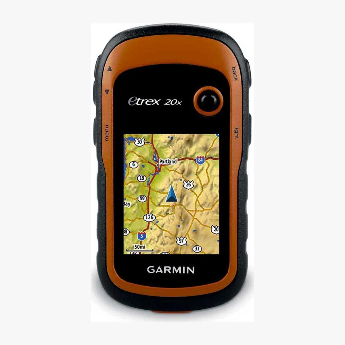
Rent a Garmin eTrex 20 GPS for Mount Elbrus
Confirm the role of each extra item with the current program and the guide.
$7.00 / day
A handheld Garmin GPS can support route recording and navigation when the user understands the device and has appropriate map data. It should supplement, not replace, a competent navigation and emergency plan.
Daily rental in Terskol. Add the item to the Mount Elbrus calculator, then send your dates and size where applicable so we can confirm availability.
Pickup in Terskol · sizes and deposit confirmed before collection
Price checked on 2026-09-12. A rental team member confirms the exact model, size or set contents and availability for your dates.
Garmin eTrex 20 GPS rental for Elbrus: what to know
Whiteout, cold and terrain can make navigation on Elbrus serious. The route leader decides the primary navigation method and backups. A rented GPS is most useful when waypoints, map coverage and battery management are prepared before departure.
How to choose a Garmin eTrex 20 GPS
- Confirm that the required maps and route data are present and understood.
- Use a device interface the responsible navigator can operate with gloves.
- Plan independent navigation and communication backups.
What to check before you rent
- Acquire a position outdoors and test buttons, screen and track recording.
- Check battery type, spare power and weather protection.
- Verify time, coordinate format and planned waypoints with the guide.
How to prepare a Garmin eTrex 20 for Mount Elbrus
The Garmin eTrex 20 is a handheld navigation device that can store waypoints, tracks and routes. Renting it does not provide route knowledge, create a safe track or make poor visibility acceptable. The user must understand the actual map and data loaded on the unit, and the guide remains responsible for the movement plan within a guided program.
Start with the official controls
Switch on the actual unit and practice changing pages, zooming the map, reading position information, opening a waypoint and following a track. Garmin provides an official eTrex 20 owner’s manual and support materials; use them before the trip rather than learning only from a short verbal explanation.
Verify the data, not the device name
Check which maps, waypoints, routes or tracks are present and whether they are intended for the current plan. A line on the screen may be old, reversed, incomplete or unrelated to current conditions. Confirm units, coordinate format, map datum, time and the meaning of every file you intend to use. Do not delete or overwrite rental data without agreement.
Power check
Open the battery compartment with staff, identify the required batteries and inspect the contacts. Use a verified matched set and carry protected spares as the guide directs. Battery life changes with settings, display use, temperature and battery condition, so a marketing maximum is not a planning guarantee.
Reception and position
Acquire satellites outdoors with a clear view of the sky and wait for a stable position before relying on the display. Compare the shown location with known surroundings. Terrain, body position and the way the device is carried can affect reception; a temporarily inaccurate position must not be forced into the route decision.
Carry and weather protection
Attach the device so that it cannot be dropped but can still be reached. Protect it from impact, leaking liquids and prolonged exposure to conditions beyond the manufacturer guidance. A waterproof description does not justify leaving the battery cover unsecured or operating damaged seals.
Navigation remains a system
Carry the other navigation and communication tools required by the plan. GPS does not replace judgment, visibility, a turnaround decision or the skills needed to interpret terrain. If you cannot confidently load, select and follow the correct data, say so before departure and do not treat the rental as a solution to that gap.
Collection checklist
- controls and pages understood;
- correct map and intended data identified;
- coordinate settings verified;
- fresh power and protected spares confirmed;
- stable outdoor position obtained;
- staff and guide responsibilities understood.
See the official Garmin eTrex 20 support and manuals and the Mount Elbrus backup-gear guide.
Electronic navigation can fail, freeze or contain incorrect data. It must not be the team’s only navigation method.
Equipment commonly considered with this item


Add it to the calculator, then adjust days and quantity
The calculator uses the same live daily price shown on this page. In winter, one 10% discount applies for four days or more, or for more than four complete sets; discounts do not stack. Summer equipment has no automatic long-rental discount. Availability, fit and the final deposit are confirmed by Rock’N’Rent.
Garmin eTrex 20 GPS questions
Can I climb Mount Elbrus independently with a rented GPS track?
A GPS track does not address weather, crevasses, altitude, route changes or rescue. Use the device only within an appropriately guided or professionally planned navigation system.
How do I reserve this item in Terskol?
Send Rock’N’Rent your dates, number of rental days and any required size on Telegram. We confirm the available item, fit where applicable, final price and deposit before collection in Terskol.
How is the rental price calculated?
The page shows the current price for one item for one calendar rental day in US dollars. In winter, one 10% discount applies for four days or more, or for more than four complete sets; discounts do not stack. There is no automatic long-rental discount on summer equipment. Availability, deposit and final amount are confirmed before collection.